
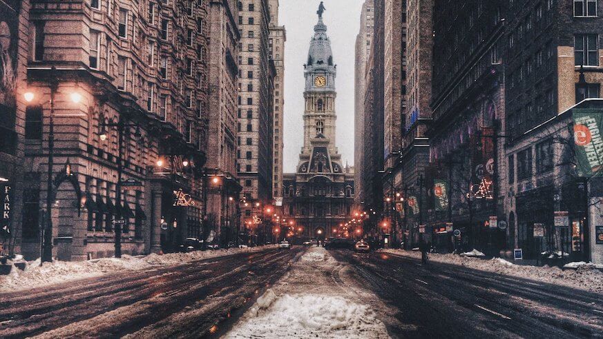
Mid-February is looking like more of a winter wonderland than December did in Philadelphia. Steadily, unrelenting snowfall that began late Sunday night continued for more than 12 hours, leaving inches of snow over the streets of Philly.
It’s a huge changes from a reported high of 67 degrees last Tuesday. But the sudden shift from warm to cold could make the weather even more risky for commuters.
While only about an inch to two and a half inches hit Monday night, even more snow is expected Monday night into Tuesday – to potentially be followed by “sleet and freezing rain,” the National Weather Service (NWS) Mt. Holly station reported in a Monday briefing – which could lead to even more hazardous conditions later in the week.
Philadelphia was forecast to get up to four more inches of snow on Tuesday as the second of two storm systems moved into the region.
School District of Philadelphia schools are planning to delay opening by two hours Tuesday. Buses will begin their normal routes two hours late as well.
But the real danger is from the forecast ice that is expected to come as well over the day Tuesday. “For many areas, ice will accumulate after a period of snowfall, leading to very hazardous travel conditions,” NWS said.
Travel impacts and power outages likely through central and eastern Pa., especially north of I-78, and parts of New Jersey, NWS said.
Shifts from warm to cold with some melting followed by refreezing could lead to particularly unpredictable conditions.
Calling the second winter storm expected to begin Tuesday “significant,” NWS said that “a wide variety of precipitation types are expected,” but that doesn’t mean the storm will be any less dangerous.
“The wide range of precipitation types means confidence in snowfall totals is lower than normal,” NWS said. “However, regardless of whether precipitation falls more as snow or as sleet/freezing rain, hazardous travel conditions are likely.”
As of Monday, school closures and delayed openings were mostly reported in the suburbs, Central Pa., South Jersey and Delaware. Philadelphia schools and city offices were all open, although Catholic schools opened with a two-hour delay. SEPTA was running with only a few reports of delays and detours and issued a warning to riders to watch out for wet, slippery or icy SEPTA platforms and parking lots.
Track-work on the Media Elwyn and Norristown High Speed lines was canceled due to the weather, so previously scheduled service changes were called off and service was back to normal.
The Ben Franklin Bridge pedestrian walkway was closed for safety reasons.
While temps Monday were set to range from 36 to 32 degrees, Tuesday was forecast to go over freezing up to around 37 degrees all day. Wednesday temps will go up to 40 with conditions predicted to be cloudy and remains in the 50s for the rest of the week before dipping back down to the 40s for the weekend.